![italiano [Beta]](http://www.escursionista.org/manzanita-theme/images/spacer.png "italiano [Beta]")
Content with tag neve .
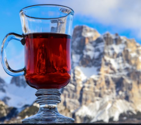
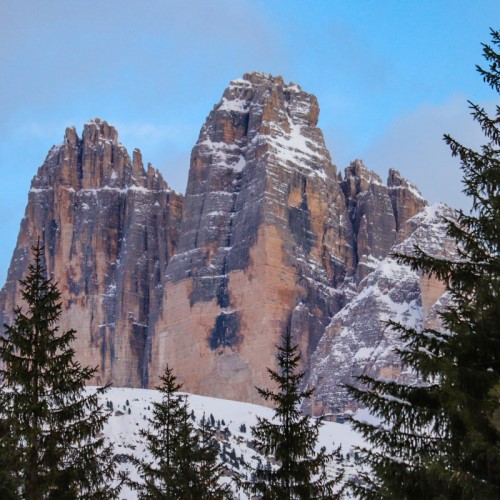
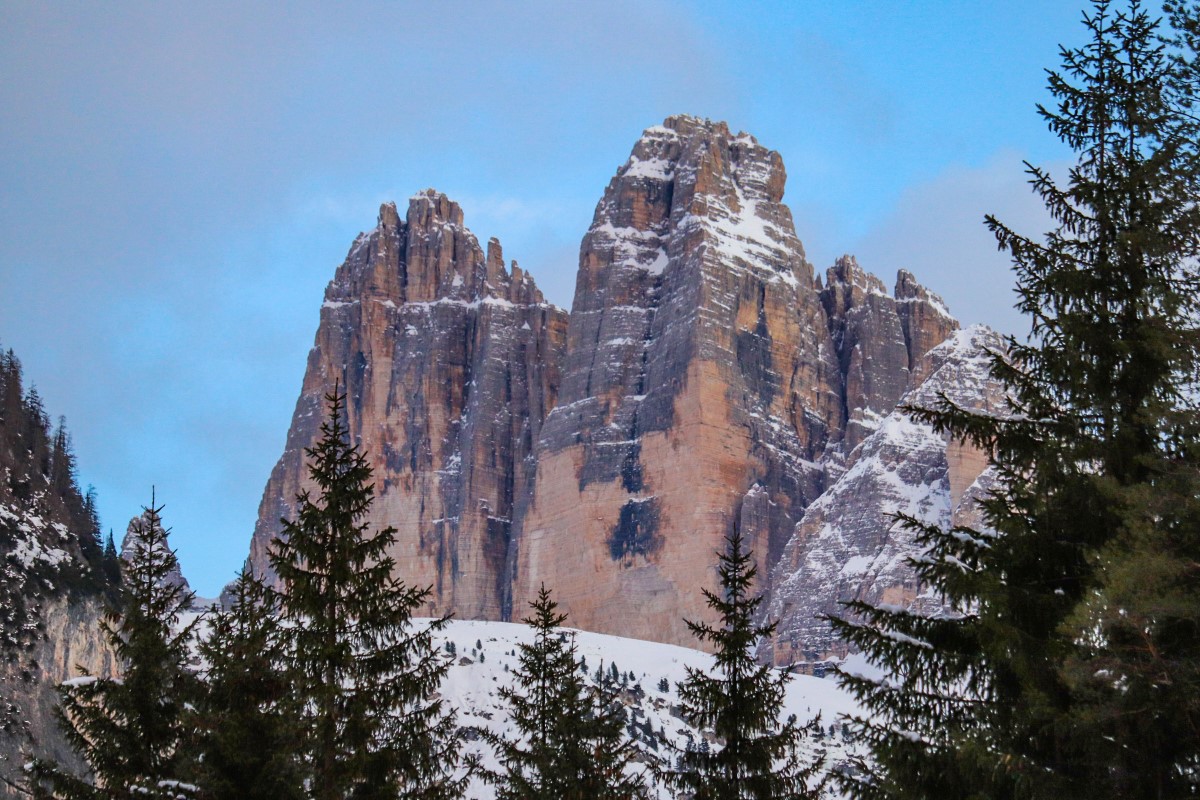
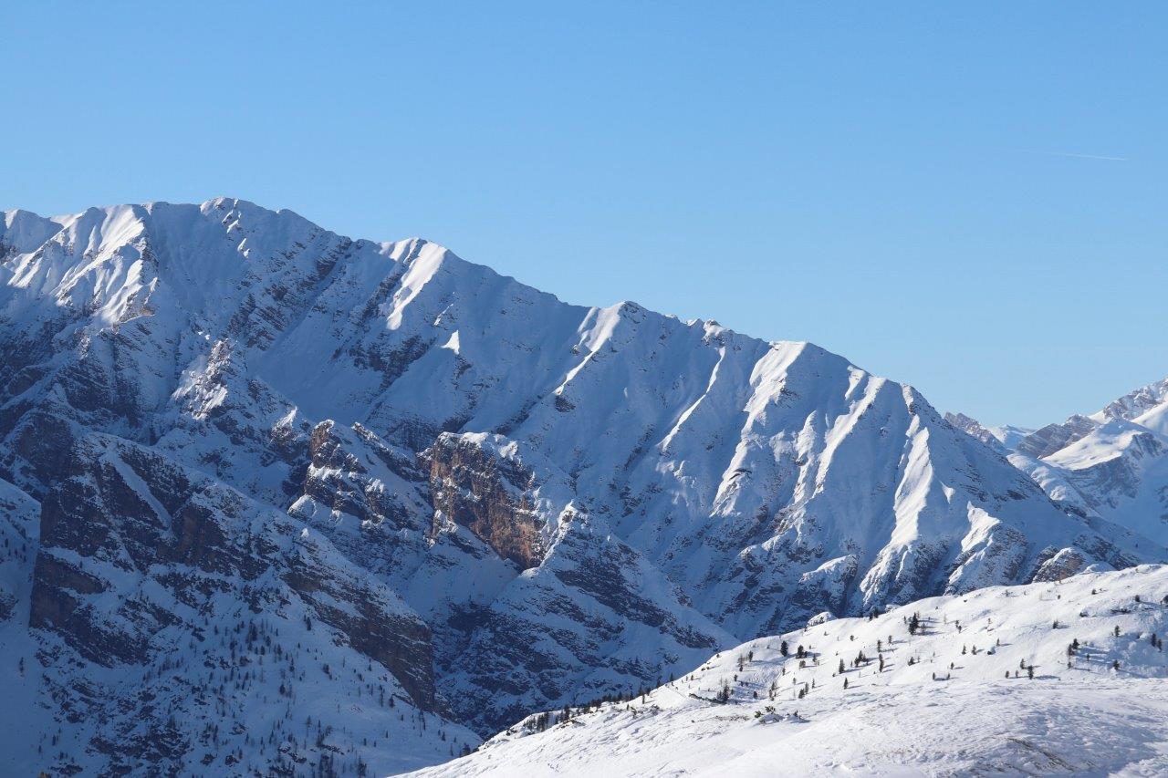
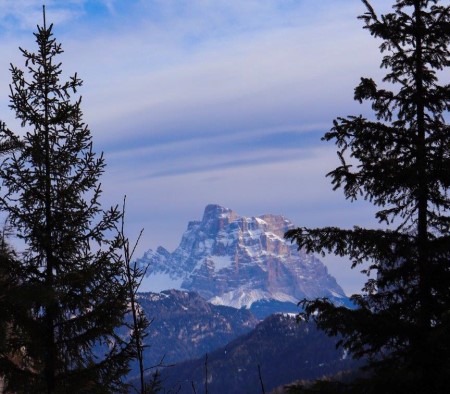
Monte Cimone da Capanno dei Celti (versante sud)
Monte Cimone da Capanno dei Celti (versante sud)
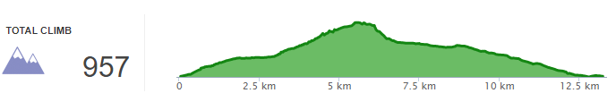
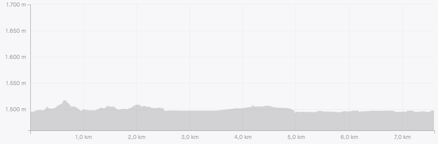
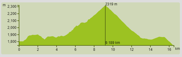
Profilo altimetrico
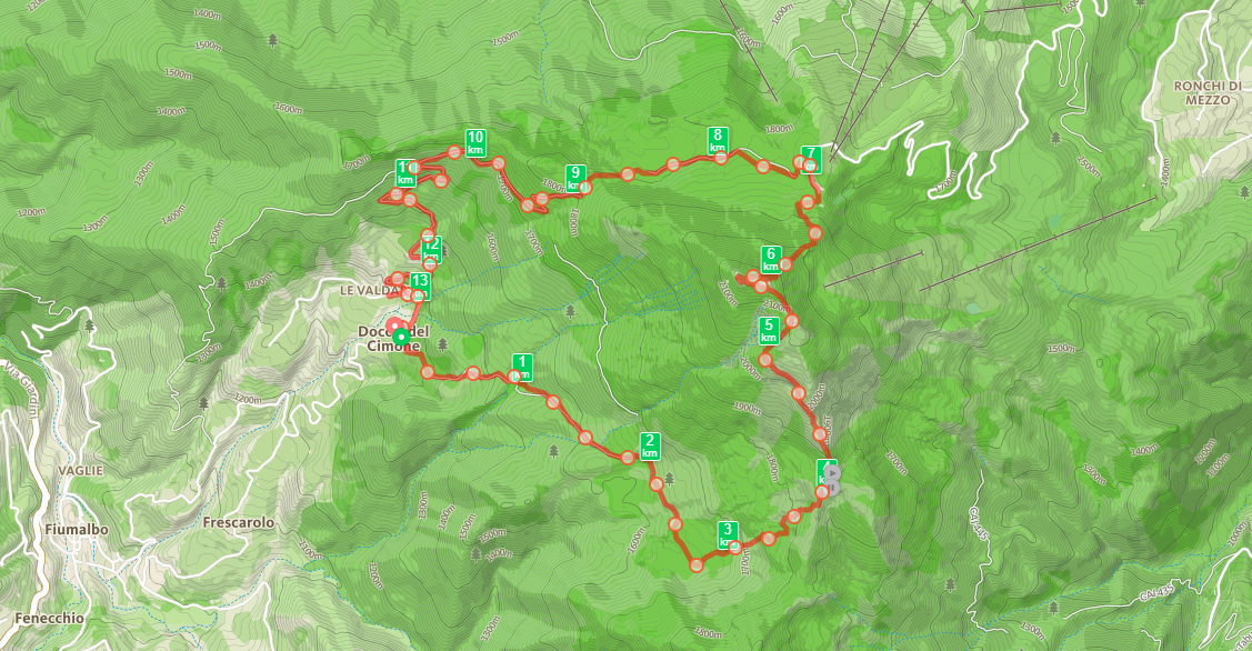
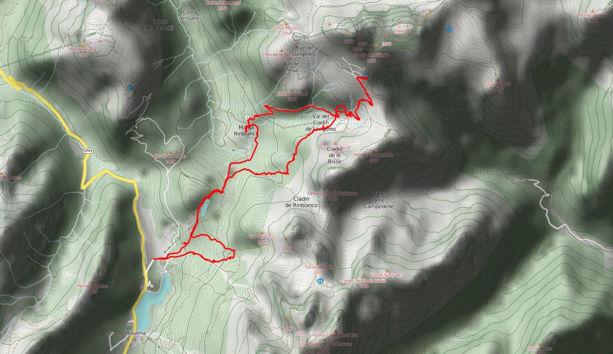
Mappa
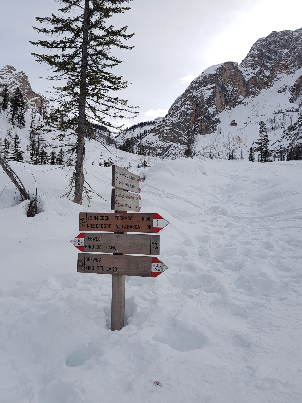
Avvicinamento
Descrizione itinerario
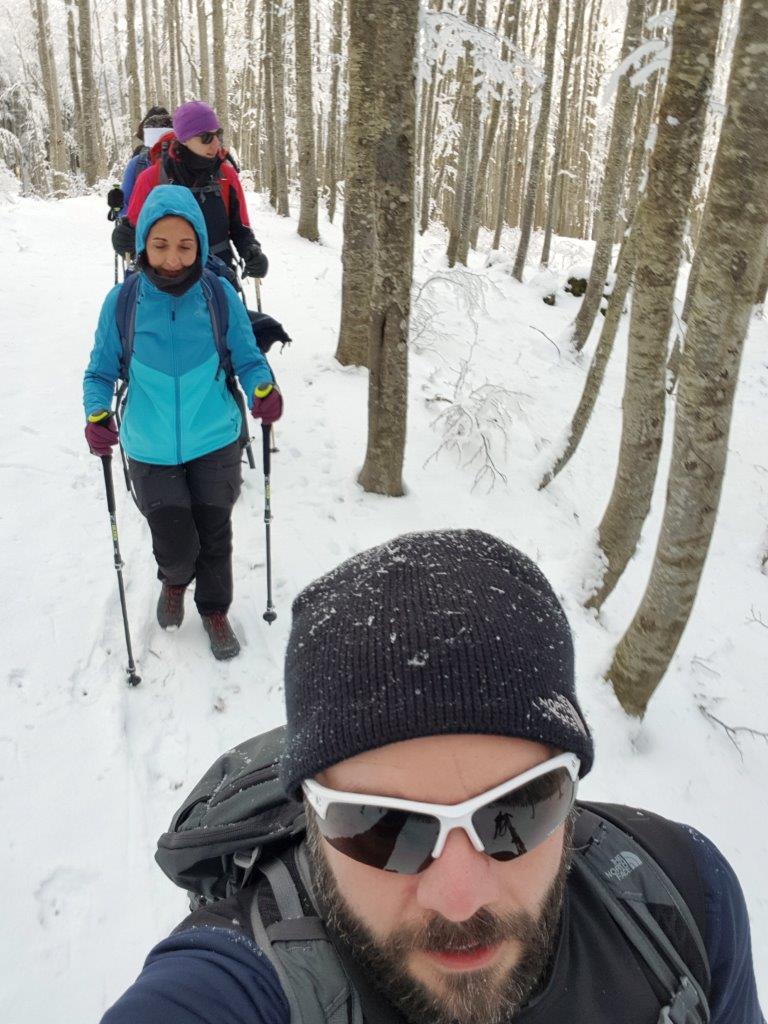
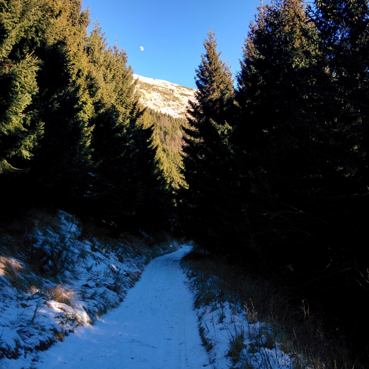
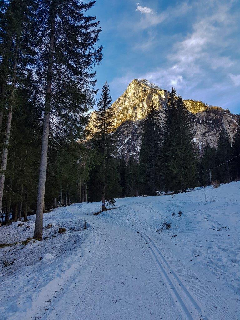
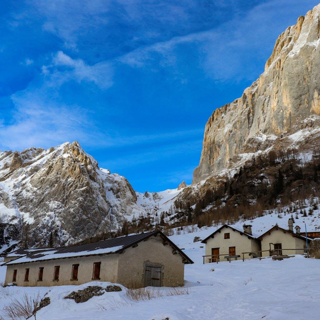
Siamo 1366 e il rifugio (quando ci sono stato io nel 2017) risulta abbandonato.
Ci guardiamo intorno e imbocchiamo il sentiero CAI 489 tra il rifugio e l’agriturismo Alpe di Sara.

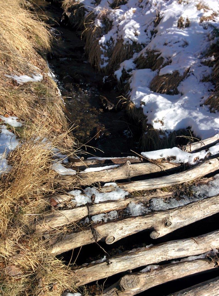
Con una deviazione rispetto alla mulattiera seguiamo sempre il sentiero CAI 489 sulla destra oltrepassando un piccolo fosso d’acqua dove c'è una casetta.
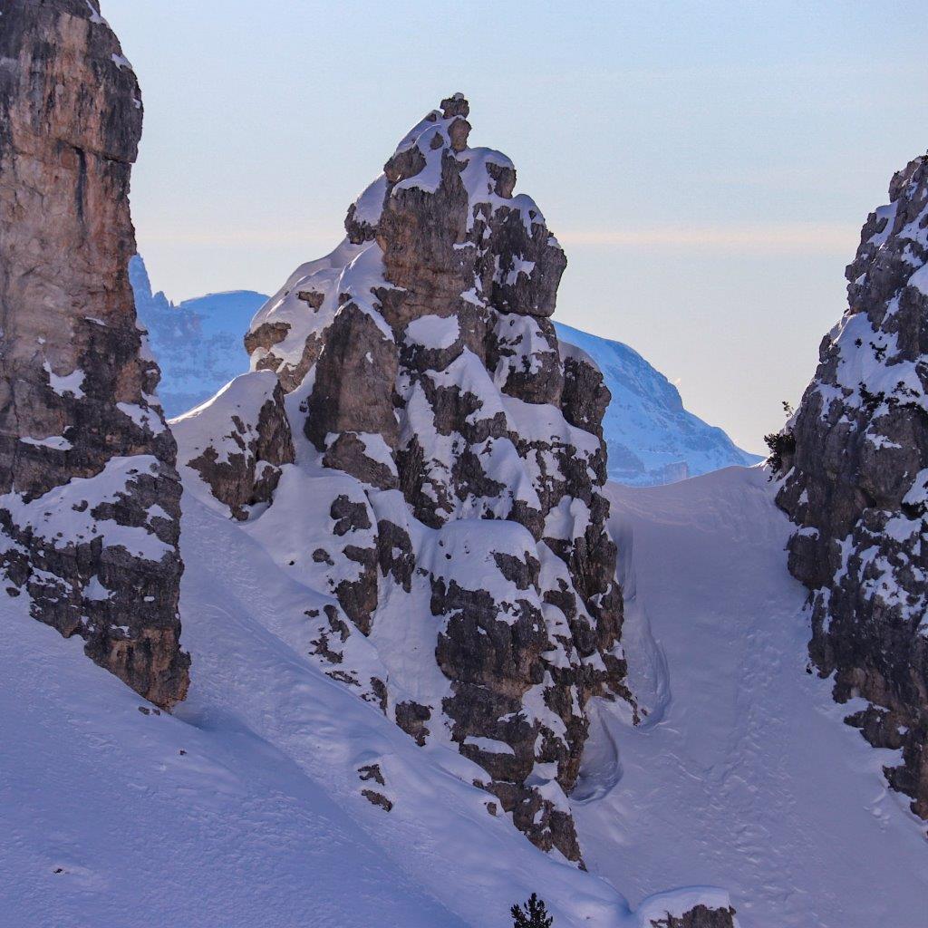
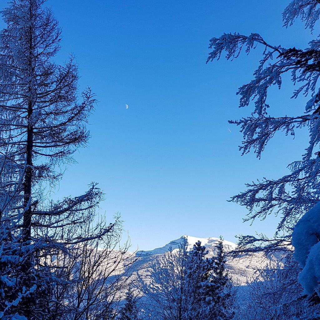
Procede in leggera discesa e poi troviamo una fonte e in breve il sentiero termina e il CAI 489 sale a sinistra per ampi spazi al ben visibile crinale. Io allargo il giro procedendo dritto per godere del bellissimo paesaggio
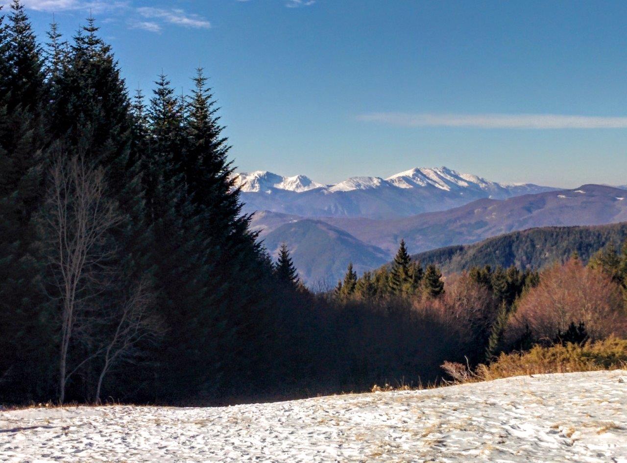
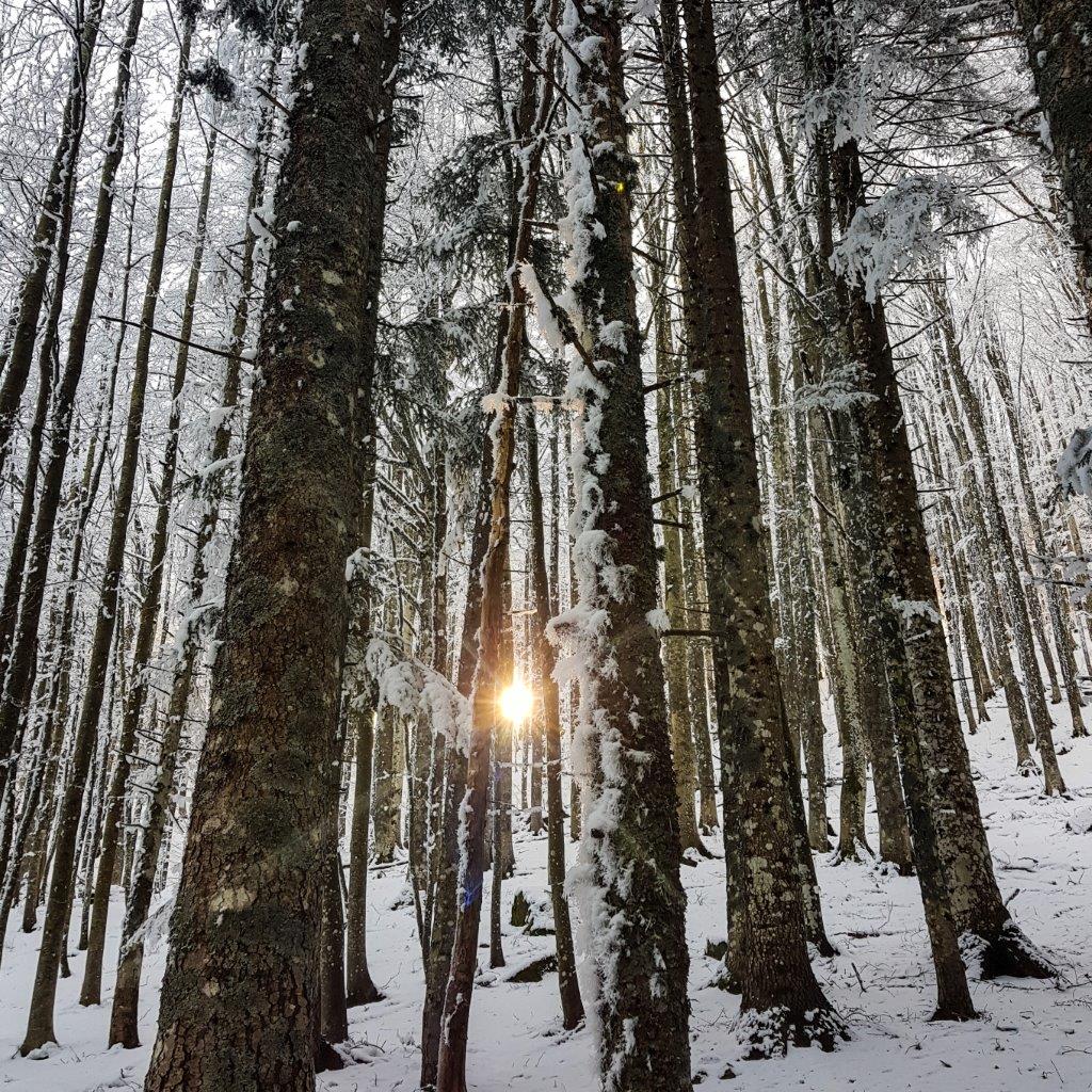
successivamente salgo per delle bellissime collinette dove trovo solo delle orme di lupo o cane, neve e alberi spogli.
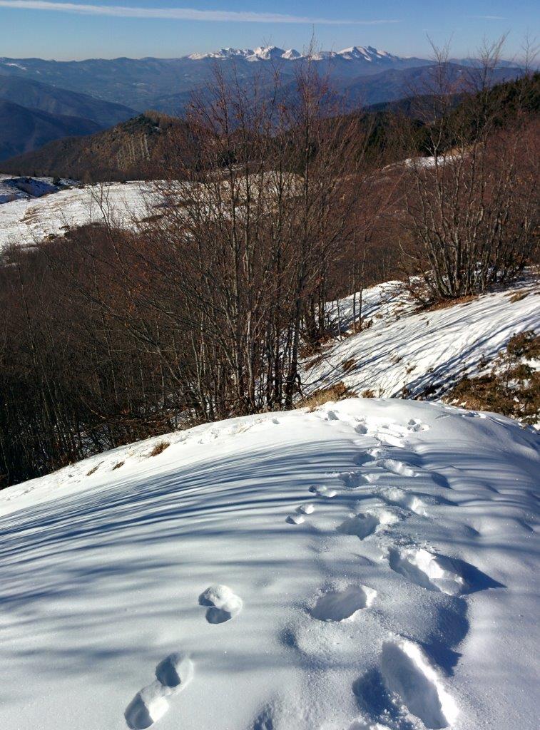
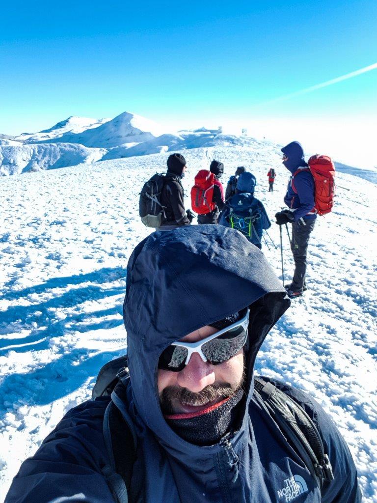
Ritrovo il sentiero 00 in cima tramite alcuni paletti del CAI
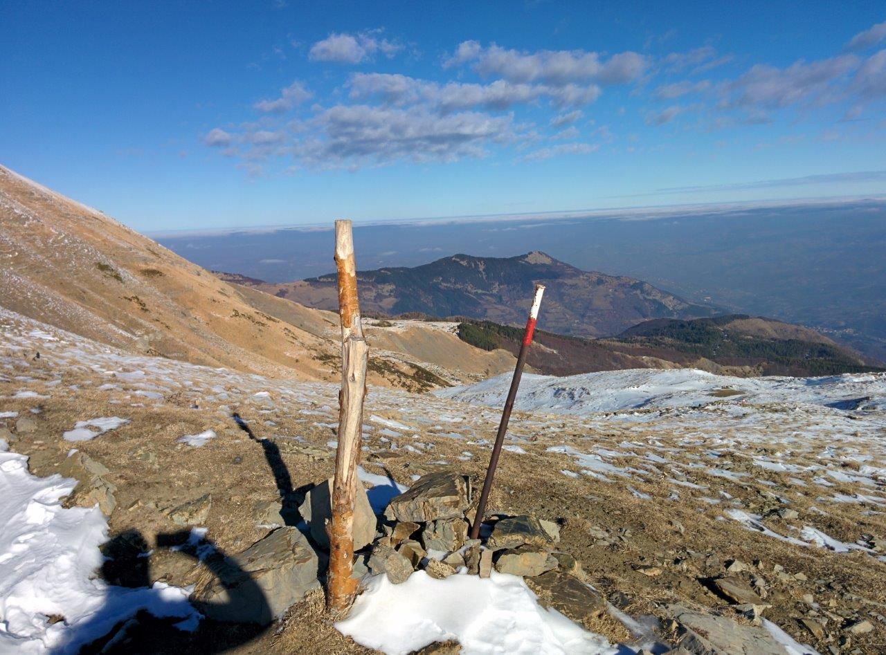
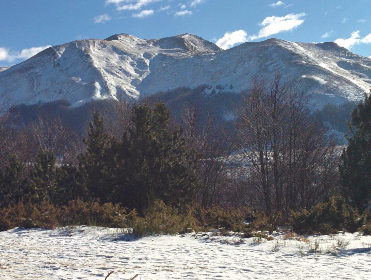
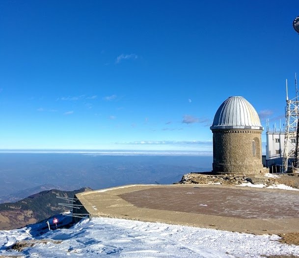
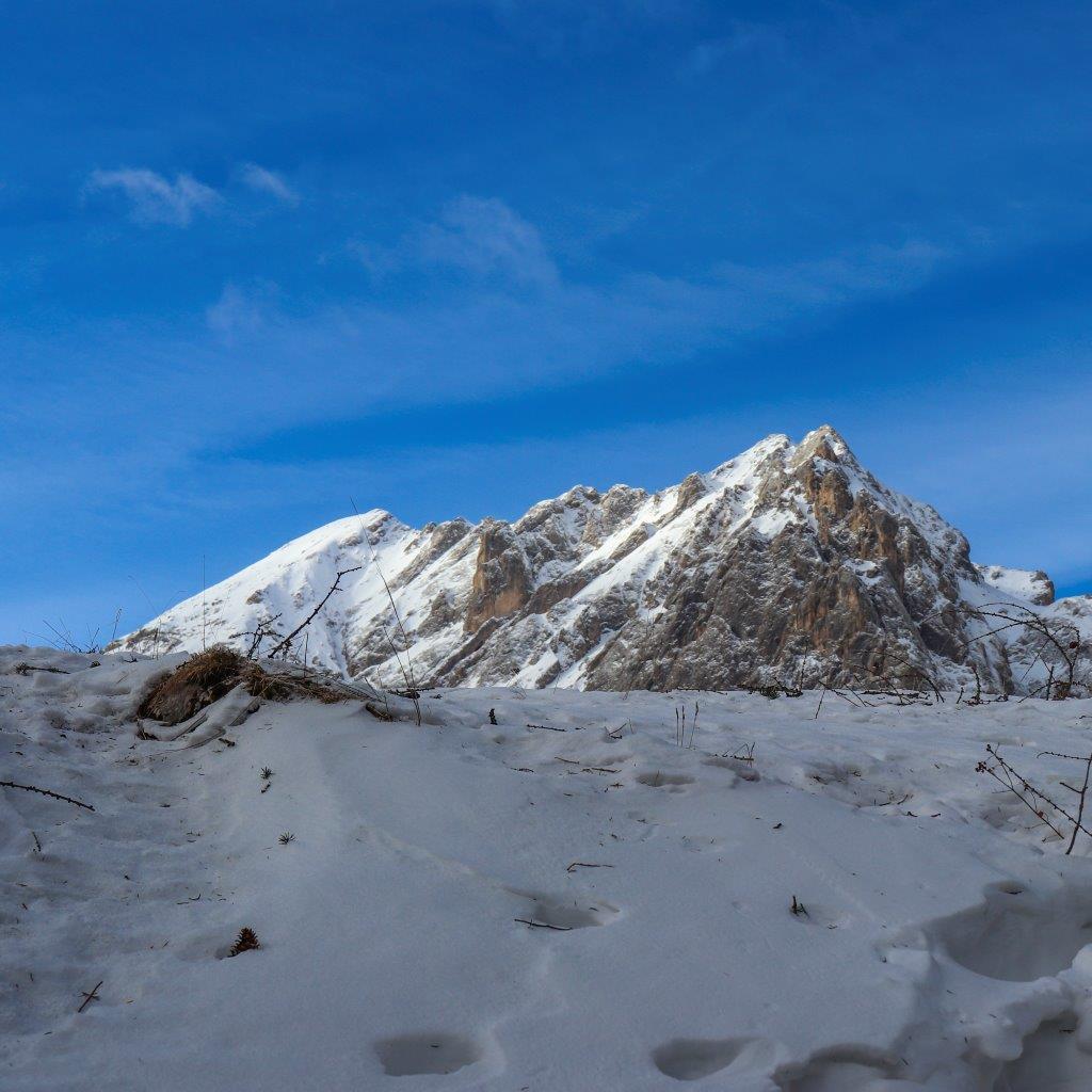
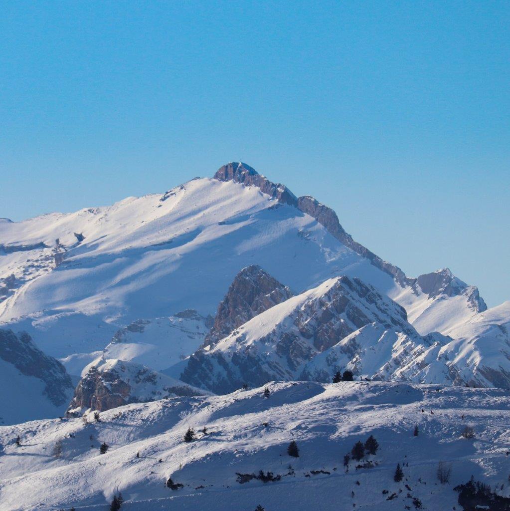
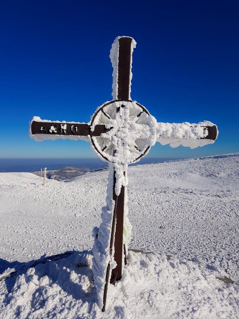
Siamo sul crinale a 1825 m su una larga sella tra Monte Lagoni e il Cimoncino, andiamo a sinistra tenendoci sempre sul crinale) – Monte Cimoncino 2118 m e vediamo la vetta del Monte Cimone q.2165 m (sulla vetta c'è l'osservatorio meteo.
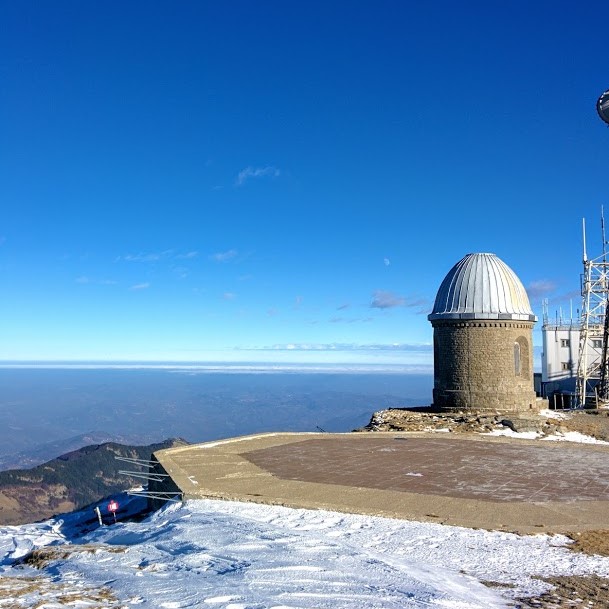
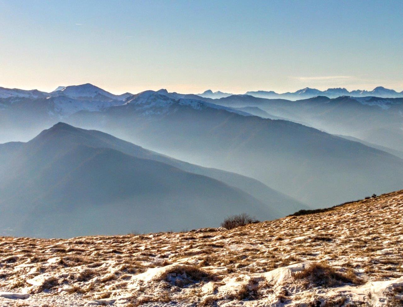
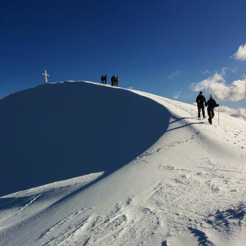
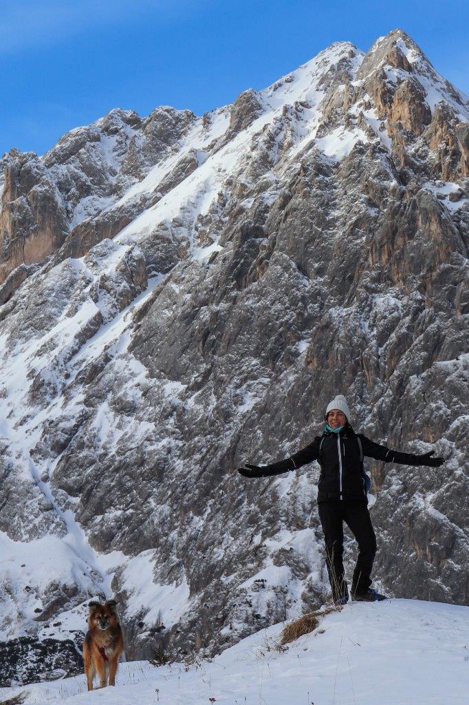
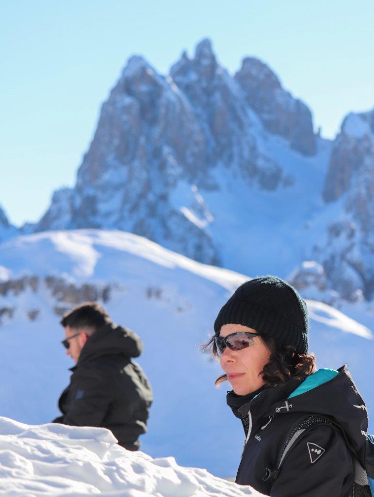
Finalmente arrivato in vetta, la più alta dell'Appennino ToscoEmiliano.
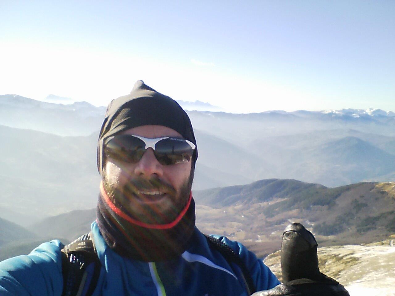
Piccola sosta per recuperare e per godere della vista

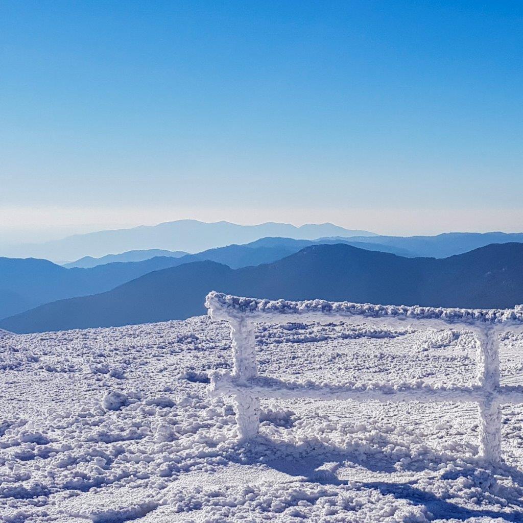
Prendiamo a scendere dritti e facciamo i balzi in direzione degli impianti si senstola che si intravedono verso il rifugio Pian Cavallaro, la discesa è bella ripida, procedo sempre dritto e quando sono in prossimità dell'edificio da dove partono gli impianti, svolto a sinistra.
C'è un grande accumulo di neve e devo stare attento a dove metto i piedi.
Il sentiero risale leggermente per poi scendere nuovamente e incrocio una mulattiera
che mi riporta verso la Capanna dei Celti 1366 m dove avevo parcheggiato.
Gallery

Guida
Ti potrebbe interessare anche:
Malga Ciapela, Valle Ombretta e Rifugio Falier
Malga Ciapela, Valle Ombretta e Rifugio Falier
Profilo altimetrico

Mappa
Avvicinamento
Descrizione itinerario
Malga Ciapéla è uno dei villaggi che compongono Rocca, frazione capoluogo del comune di Rocca Pietore (provincia di Belluno).
Sorge alle pendici della Parete Sud della Marmolada. Da qui transita l'alta via n.2 delle Dolomiti e partono gli impianti di risalita per la Marmolada che in pochi minuti portano a 3265 metri di Punta Rocca ed è il centro geografico esatto delle Dolomiti UNESCO Patrimonio dell'Umanità.
Arrivati al parcheggio si procede sulla stada che è una carrareccia molto larga e ben visibile, si segue sempre il sentiero CAI 610, arrivati all'Agriturismo Malga Ciapela non si nota, ma bisogna proseguire dritti tenendo l'agriturismo sulla sinistra.
Camminando si incontra una pista da sci di fondo.
I boschi sono meravigliosi e iniziano a scorgersi le vette dei dintorni.
La salita inizia a farsi sentire e ci sono una serie di tornanti. Seguiamo sempre il sentiero 610 fino ad incontrare un punto esposto.
Una frana ha parzialmente ridotto il passaggio, è ghiacciato, per cui prestare molta attenzione.
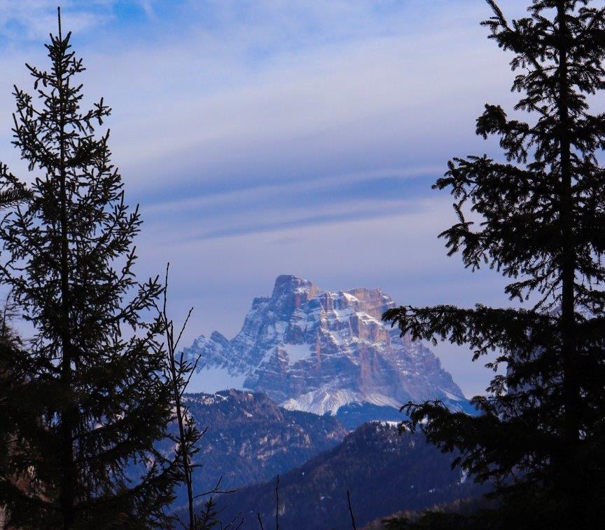
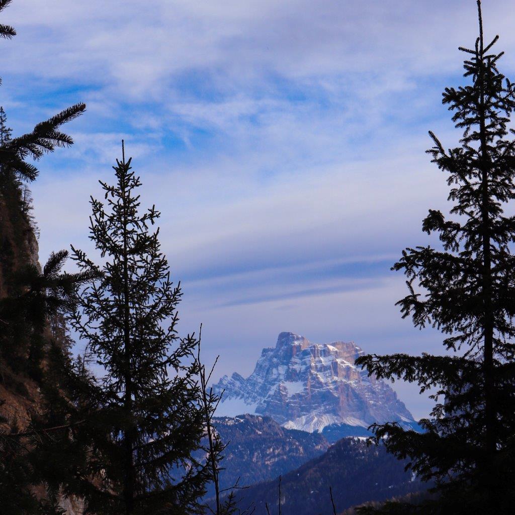
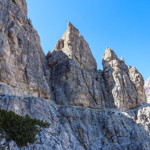
La vista si apre ed è stupefacente, il Monte Pelmo (el Caregon del Padreterno) è ben visibile tra le pendici di valle Ombretta.
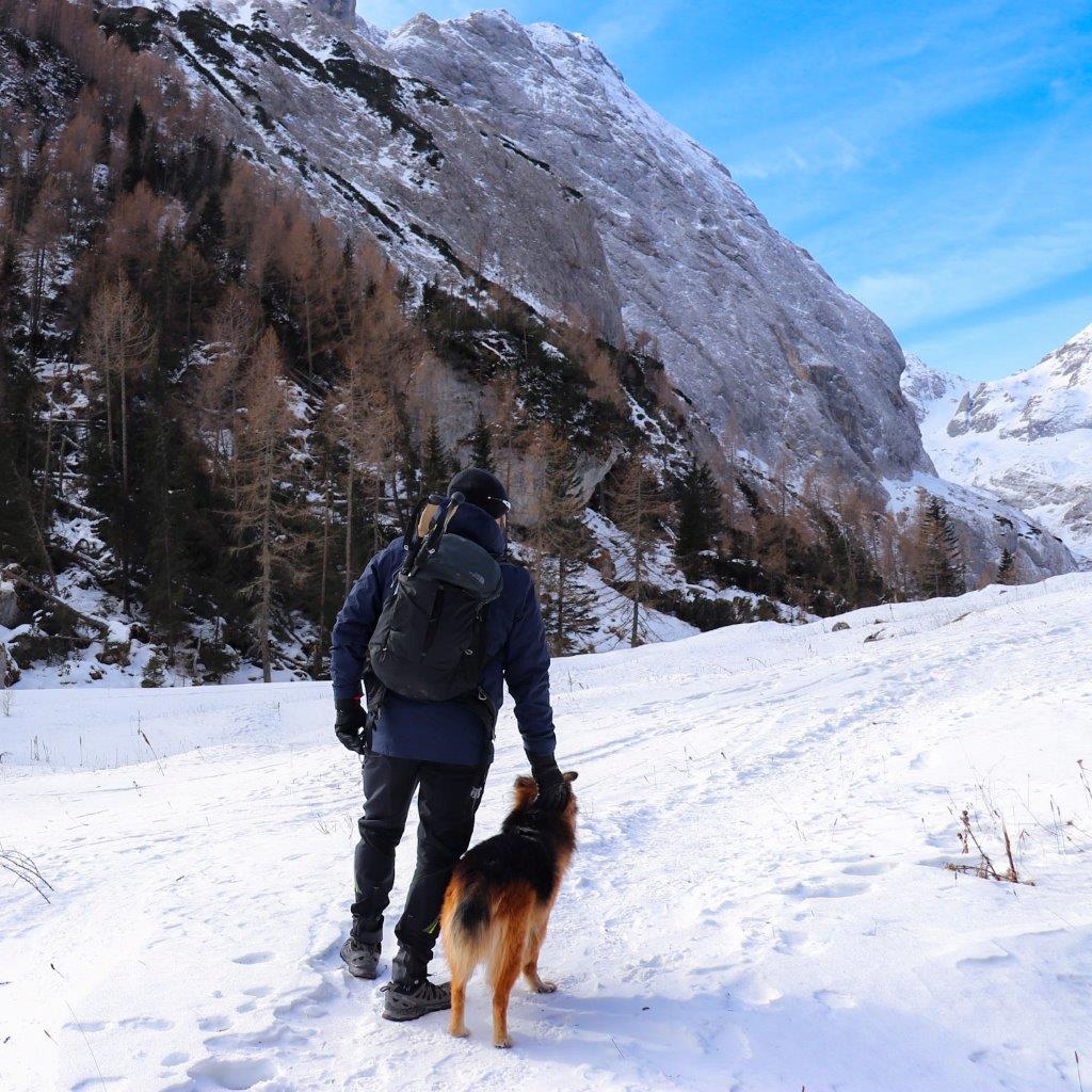
Salendo arriviamo verso una vallata circondati da bellissime cime innevate.
Ci facciamo qualche foto prima di rimetterci in cammino, il posto è cinematografico e bellissimo.
Dopo qualche metro nella neve alta circa 10 cm arriviamo a Malga Ombretta (ovviamente chiusa vista la stagione).
Facciamo una sosta per rifocillarci usando le panche di legno davanti alla malga e ci rimettiamo in cammino verso il rifugio Falier.
Attenzione, il percorso in inverno non è facilmente individuabile, ci sono un po' di accumuli di neve (anche 40-50cm), per cui si consiglia l'abbigliamento adeguato, scarponi alti e ghette.
L'ultimo tratto diventa più duro e si inizia a fare sul serio, ma il paesaggio è veramente incantevole, si vede il Monte Pelmo a distanza.
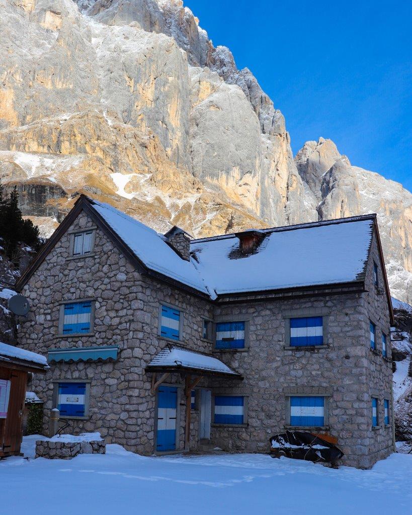
Dopo alcuni tornanti eccoci arrivati al Rifugio Falier.
Nel nosto caso abbiamo rifatto il sentiero al contrario per rientrare.
Gallery
Guida
Ti potrebbe interessare anche:

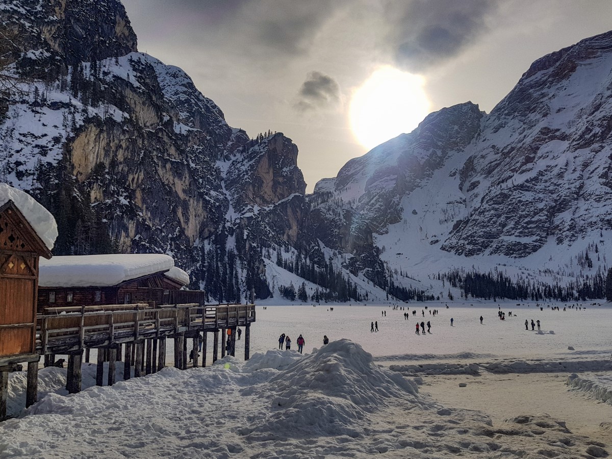
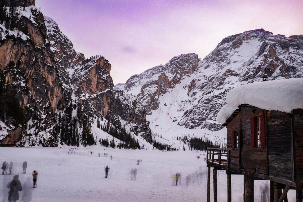
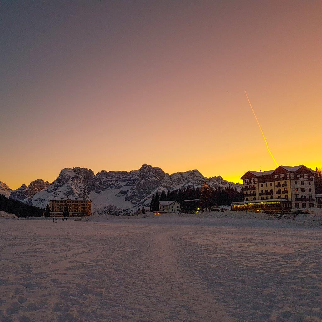
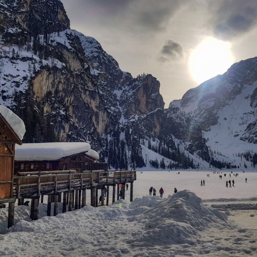
a ring around the Lago di Braies in the winter
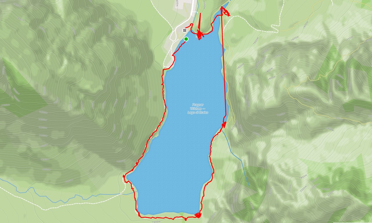
a ring around the Lago di Braies in the winter
Profilo altimetrico
Mappa
Avvicinamento
Descrizione itinerario
The lake is the starting point of the Alta Via n. 1 of the Dolomites called "Classical" of up to Belluno at the foot of the Schiara Group.
The legend tells of savages who take to the mountains of Pragsertal in search of gold and stones. Greedy and envious shepherds of the valley attempted to steal their treasures, but failed because, to protect the treasure, they opened the subterranean fountains and threw the treasure into the lake of Braies.
 The Pragsertal, notably the Lake Braies, are part of the film set of the television series "One step from heaven" with Terence Hill and later with Daniele Liotti. Between 2010 and 2018 you were shot about 70 episodes. In the film, however, the lake is named "Lake San Candido
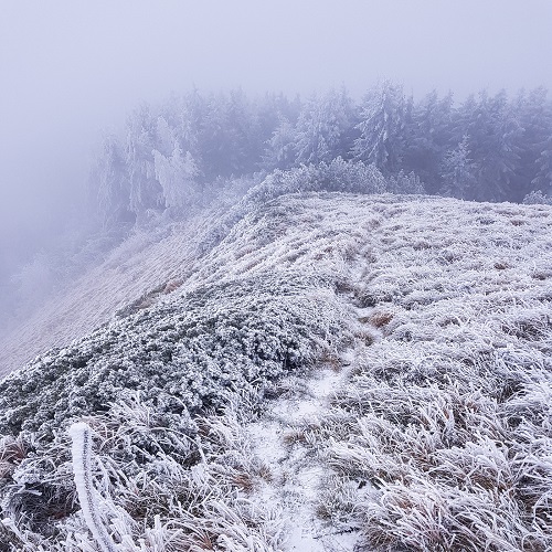
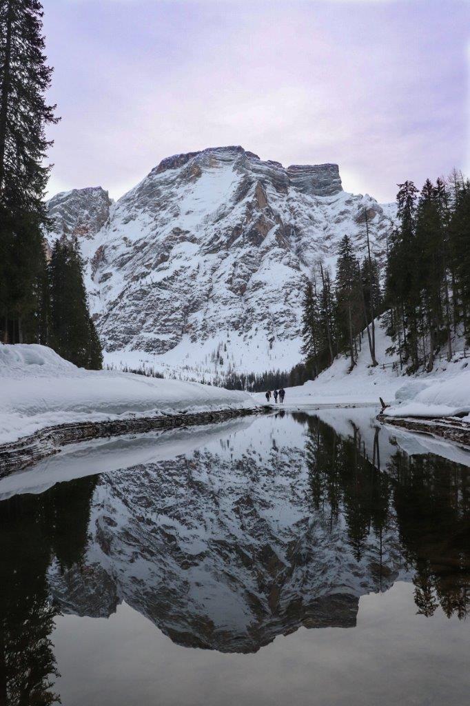
Around the lake it is very simple but esssendo in snowy environment recommend appropriate clothing for winter / ice.
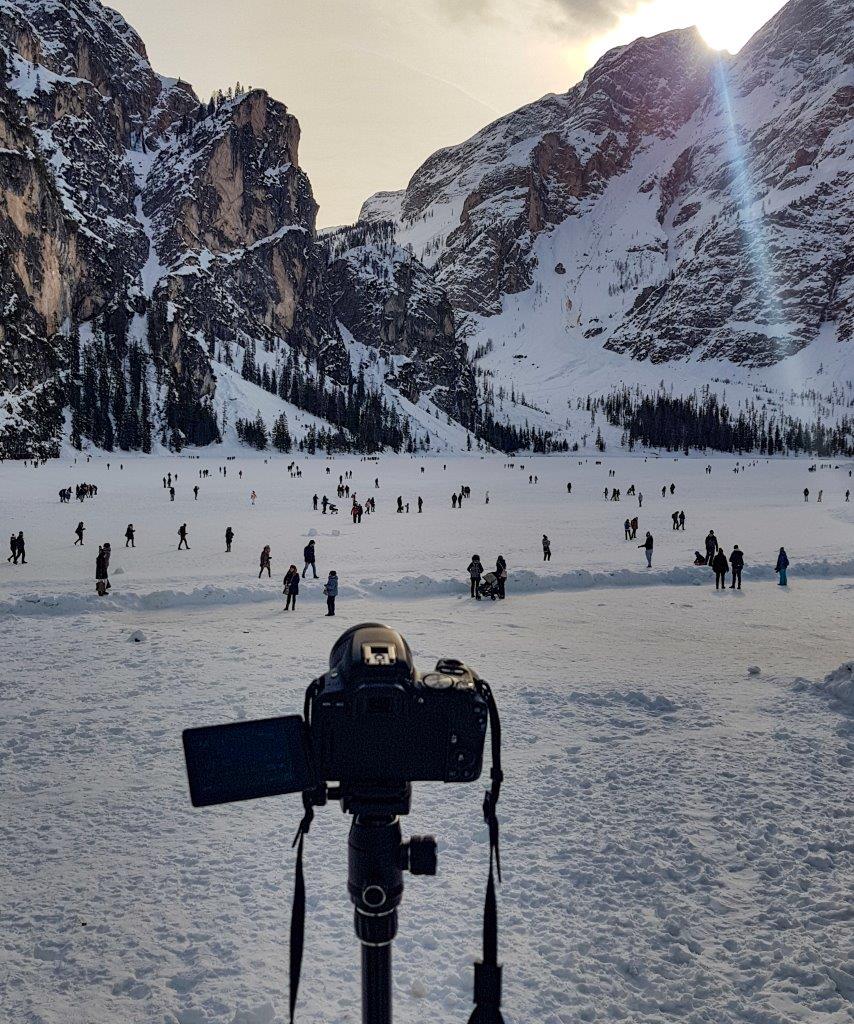
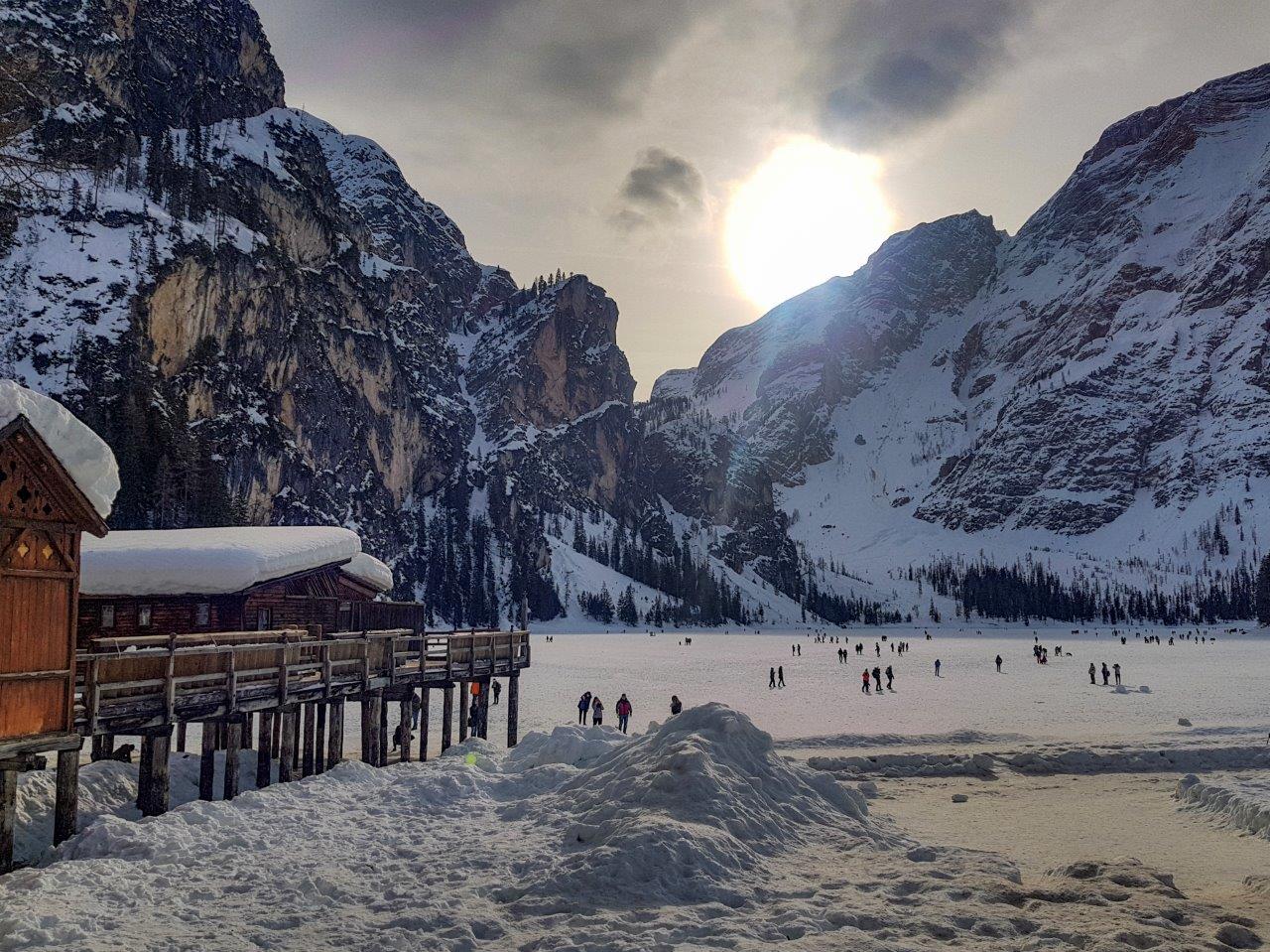
The trail is well marked and in some places it is interrupted because of too much snow that makes it dangerous, in which case you can go down on the frozen lake and walking.
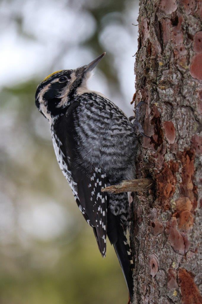
Strolling I met a beautiful woodpecker broke the bark to eat the insects hidden underneath, completely indifferent to our presence was left free photography.
You can admire the beautiful reflections
The beautiful wooden structure that is seen is not a cabin, but need to control the boat that you can rent in the summer.
Gallery
Guida
Ti potrebbe interessare anche:
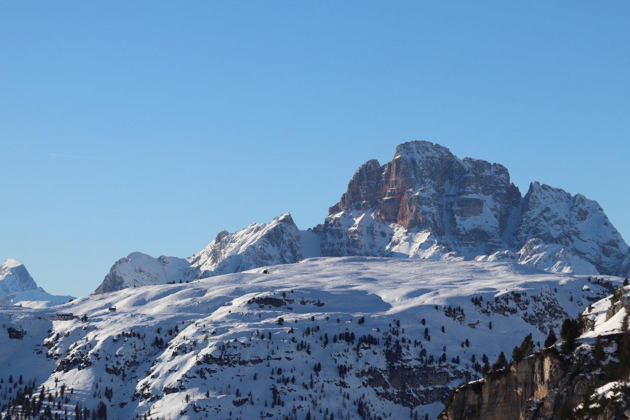
From Lake Misurina to the Three Peaks snow
One of the most photographed places in the world are undoubtedly the Tre Cime di Lavaredo and Misurina Lake with the massive Crystal behind the group. Immersin A hike in the snow in the middle of untouched nature. Among historical peaks as protagonists of World War I: the beautiful Belluno Dolomites, UNESCO World Heritage Site.
Profilo altimetrico
Mappa
Avvicinamento
Descrizione itinerario
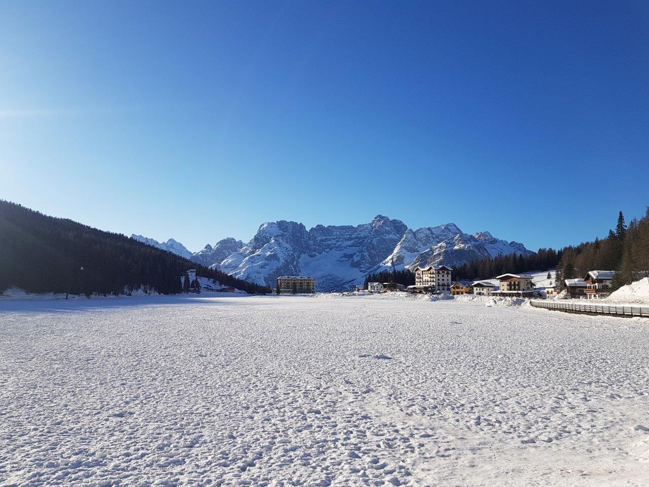
We enjoy the beautiful view of the massif directly from Crystal Lake Misurina, which this season is completely frozen and you can walk on without problems, the lake is not very deep and in winter it becomes a fabulous skating rink.
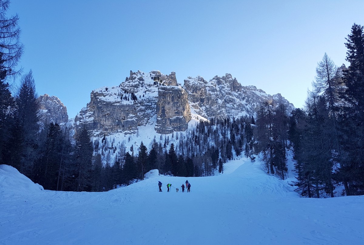
We walk towards Lake Around, Malga Rinbianco, Three Peaks.
The road is clean and we follow the road to the junction a few meters towards the three peaks and keep to the right. Now we are moving to the right (next to the ski slopes in disuse), trail no. 101 which for a stretch overlaps the 115.
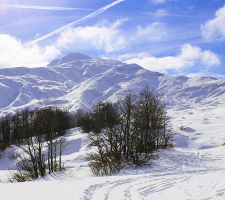
The climb is very tiring but the view is wonderful and the Three Peaks are there watching us.
After a while 'we find ourselves at a crossroads, where the ski slopes are to the right and we turn left towards Lago D'around.
From the track we go to a real path which obviously narrows and we have a long curve to return later on the asphalt road.
The snow there and have some snowshoes avoids sinking from time to time with the boots.
Once Around the Lake, along a short stretch of paved road, we are faced with a barrier from where you can take the snowmobile to get to the Three Peaks. The ticket price is 30 Euros per person A / R. We obviously we walk.
We walk down the road for a few meters and follow the signs for trail 101 to Rifugio Auronzo.
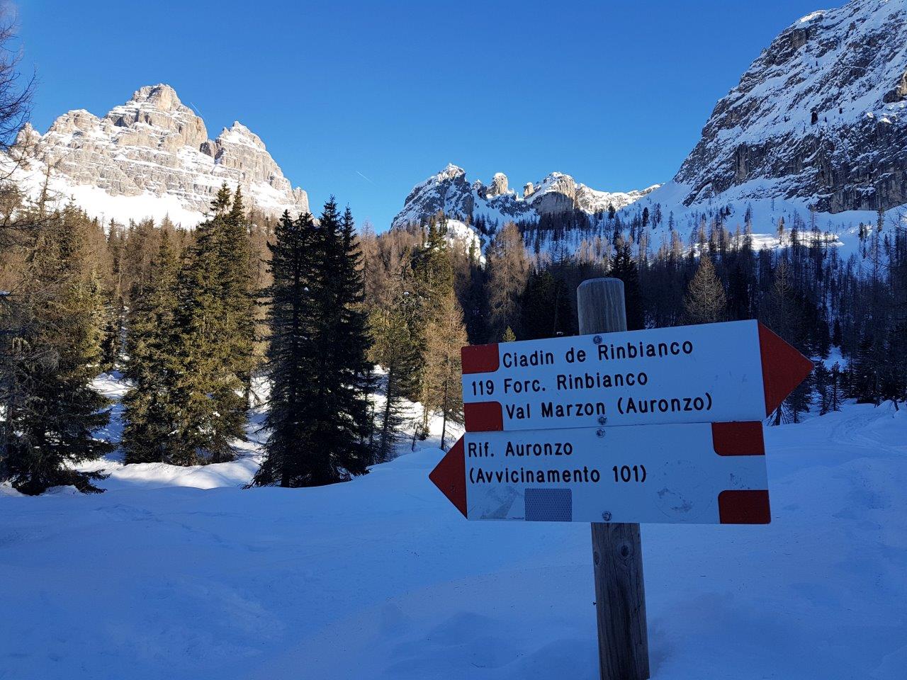
At this point the path is immersed in the woods and after a climb with beautiful bends do a crosspiece to which advice the use of snowshoes because the snow accumulated (and well compact) is about 1.5 meters.
We ford a small stream, there are bridges and is not very difficult to pass.
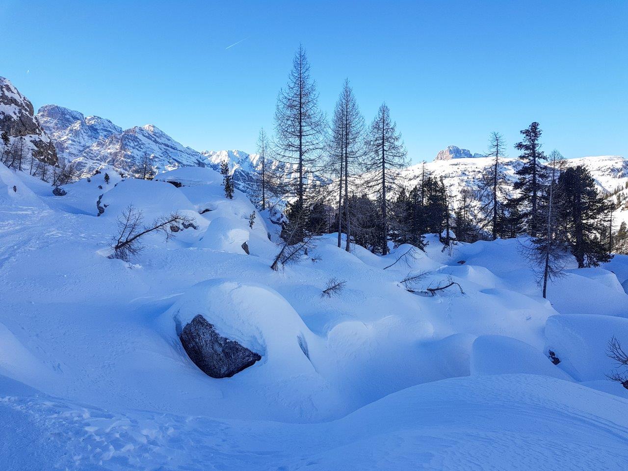
We are facing a natural spectacle, a wonder of snow, mountains and the play of light and shadow.
We continue to the refuge Auronzo starting to look in the distance and we rejoin the road (which is snow-covered) to make a short and well-deserved break at the refuge where we eat something.
The show is great and we have the three peaks on the one hand, Cadini Misurina from the other and so many other wonderful peaks just waiting to be admired.
At this point we go back on the road and decided to return to the lake following it to the end.
The descent offers beautiful views and I stop to take some spectacular photos.
The sun is going down and the colors start to show up
Arriving at the lake we enjoy the view at sunset with the crystal in front of us.
Gallery
Guida
Ti potrebbe interessare anche:
Passo della Croce Arcana, Colle dell'acqua marcia partendo dal Capanno Tassoni
Passo della Croce Arcana, Colle dell'acqua marcia partendo dal Capanno Tassoni
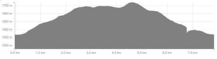
Profilo altimetrico
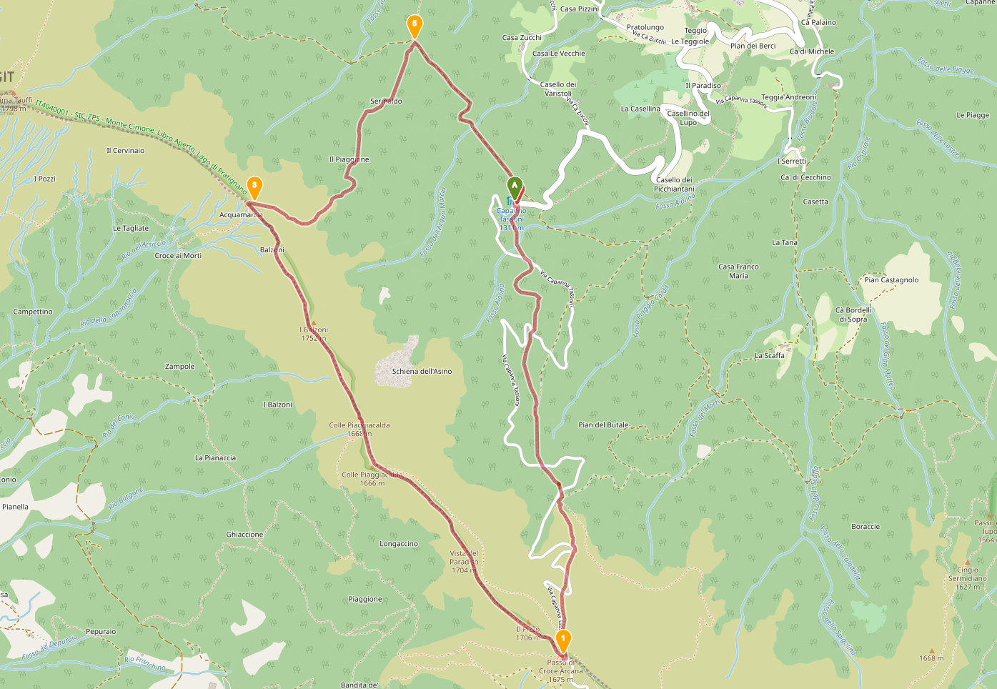
Mappa
Avvicinamento
Descrizione itinerario
In passato veniva chiamato il passo dell'Alpe alla Croce, è il valico della Croce Arcana, ed era molto trafficato fino dal basso Medioevo per gli spostamenti dalla Toscana alla pianura Padana e viceversa.
I documenti più antichi risalgono all'epoca longobarda, quando Pistoia era la città regia e i bizantini si erano ritirati verso oriente anche sulla montagna pistoiese, chiamata all'epoca Montagna alta.
Il panorama è a 360 gradi e va da tutta la valle della Lima alle cime più elevate dell'Appennino tosco-emiliano, alle vallate del pistoiese, del modenese e del bolognese e quando è sereno in lontananza si scorgono anche le vette delle Alpi Apuane e le Alpi.
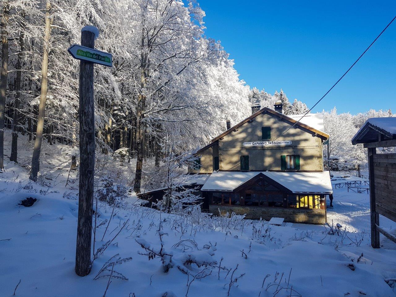
Partenza dal Capanno Tassoni
Prendere il sentiero 413 e seguire per "Croce Arcana".
Seguire il sentiero - molto semplice - fino al crinale "Passo della Croce Arcana".
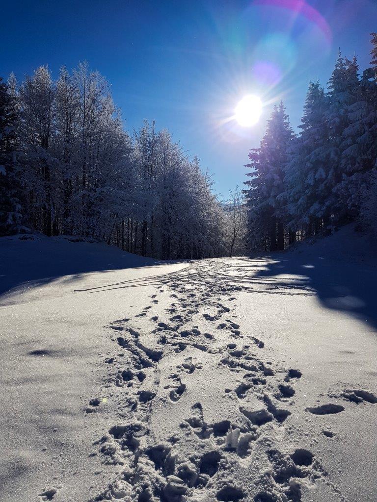
Man mano che si sale il vento diventa sempre più forte.
Per strada incontriamo delle persone equipaggiato con "Kyte snow", una vela e uno snowboard, deve essere una figata.
Una volta in vetta appare la famosa Croce Arcana che da il nome all'omonimo passo.
Svoltare a destra in direzione nord verso Cima Tauffi, Libro Aperto seguire il sentiero CAI 00.
La vista è mozzafiato e guardando verso sud appare lo spigolino, Corno alle scale e il monte gennaio.

Un vista sulle mopntagne toscane e addirittura in un punto si vede addirittura il Mar Tirreno.
Arrivati al Colle dell'acqua Marcia, prendere a destra il sentiero CAI 417 che scende (abbastanza ripidamente) verso la forestale sentiero CAI 445, larga e ben visibile che ci riporta al Capanno Tassoni.
Gallery